

| << Chapter < Page | Chapter >> Page > |
An excellent 4-minute video tour of Valles Marineris, narrated by planetary scientist Phil Christensen, is available for viewing.
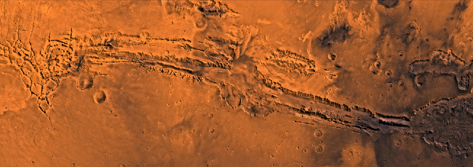
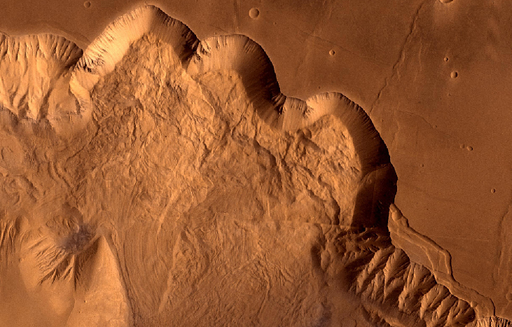
The term “canyon” is somewhat misleading here because the Valles Marineris canyons have no outlets and were not cut by running water. They are basically tectonic cracks, produced by the same crustal tensions that caused the Tharsis uplift. However, water has played a later role in shaping the canyons, primarily by seeping from deep springs and undercutting the cliffs. This undercutting led to landslides that gradually widened the original cracks into the great valleys we see today ( [link] ). Today, the primary form of erosion in the canyons is probably wind.
While the Tharsis bulge and Valles Marineris are impressive, in general, we see fewer tectonic structures on Mars than on Venus. In part, this may reflect a lower general level of geological activity, as would be expected for a smaller planet. But it is also possible that evidence of widespread faulting has been buried by wind-deposited sediment over much of Mars. Like Earth, Mars may have hidden part of its geological history under a cloak of soil.
The first spacecraft to land successfully on Mars were Vikings 1 and 2 and Mars Pathfinder. All sent back photos that showed a desolate but strangely beautiful landscape, including numerous angular rocks interspersed with dune like deposits of fine-grained, reddish soil ( [link] ).
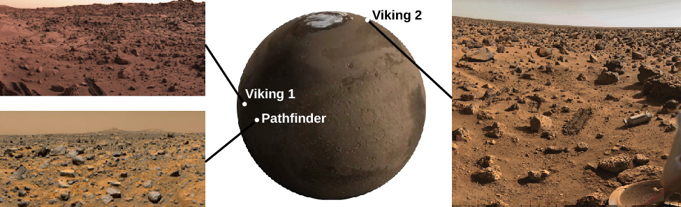
All three of these landers were targeted to relatively flat, lowland terrain. Instruments on the landers found that the soil consisted of clays and iron oxides, as had long been expected from the red color of the planet. All the rocks measured appeared to be of volcanic origin and roughly the same composition. Later landers were targeted to touch down in areas that apparently were flooded sometime in the past, where sedimentary rock layers, formed in the presence of water, are common. (Although we should note that nearly all the planet is blanketed in at least a thin layer of wind-blown dust).
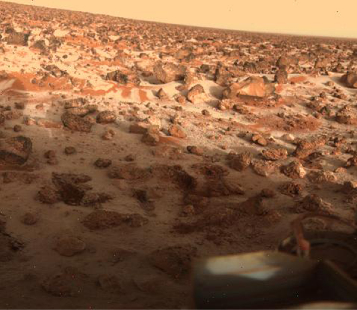
The Viking landers included weather stations that operated for several years, providing a perspective on martian weather. The temperatures they measured varied greatly with the seasons, due to the absence of moderating oceans and clouds. Typically, the summer maximum at Viking 1 was 240 K (–33 °C), dropping to 190 K (–83 °C) at the same location just before dawn. The lowest air temperatures, measured farther north by Viking 2, were about 173 K (–100 °C). During the winter, Viking 2 also photographed water frost deposits on the ground ( [link] ). We make a point of saying “water frost” here because at some locations on Mars, it gets cold enough for carbon dioxide (dry ice) to freeze out of the atmosphere as well.
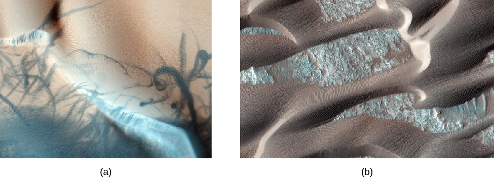
Most of the winds measured on Mars are only a few kilometers per hour. However, Mars is capable of great windstorms that can shroud the entire planet with windblown dust. Such high winds can strip the surface of some of its loose, fine dust, leaving the rock exposed. The later rovers found that each sunny afternoon the atmosphere became turbulent as heat rose off the surface. This turbulence generated dust devils, which play an important role in lifting the fine dust into the atmosphere. As the dust devils strip off the top layer of light dust and expose darker material underneath, they can produce fantastic patterns on the ground ( [link] ).
Wind on Mars plays an important role in redistributing surface material. [link] shows a beautiful area of dark sand dunes on top of lighter material. Much of the material stripped out of the martian canyons has been dumped in extensive dune fields like this, mostly at high latitudes.
Most of what we know about Mars is derived from spacecraft: highly successful orbiters, landers, and rovers. We have also been able to study a few martian rocks that reached Earth as meteorites. Mars has heavily cratered highlands in its southern hemisphere, but younger, lower volcanic plains over much of its northern half. The Tharsis bulge, as big as North America, includes several huge volcanoes; Olympus Mons is more than 20 kilometers high and 500 kilometers in diameter. The Valles Marineris canyons are tectonic features widened by erosion. Early landers revealed only barren, windswept plains, but later missions have visited places with more geological (and scenic) variety. Landing sites have been selected in part to search for evidence of past water.
Notification Switch
Would you like to follow the 'Astronomy' conversation and receive update notifications?

|
|

|
|

|
|
|
|
|
|
|
|

|
|

|
|

|
|

|
|

|